
The Met Office has pinpointed where snow could descend later this week as temperatures are predicted to take a nosedive.
Despite last week delivering the warmest day of the year so far with the mercury climbing above 19C in London, this week has commenced on a more dismal note.
Tomorrow is set to be "cloudy again for most" with rain shifting from west to east, and additional showers arriving in western regions in the evening, according to the Met Office. Temperatures are then anticipated to become chillier on Friday.
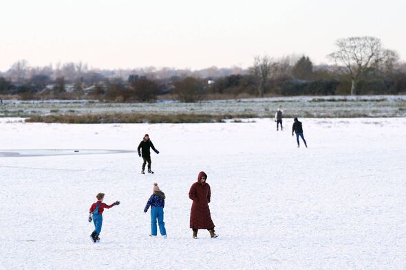
Snow is also feasible on Friday, and it might not just be restricted to hills in northern areas.
Jason Kelly, Chief Operational Meteorologist for the Met Office, stated: "A notable shift in wind direction to a north-westerly flow will bring a markedly colder day nationwide on Friday, with the potential for a mixture of sunny spells, heavy showers, coastal gales, and snow over high ground."

"There's also the possibility of accumulations on lower hills too. The picture will become clearer closer to the time, so keep an eye on our forecast as the week progresses."
Looking further ahead, the Met Office suggests "changeable" conditions are probable from March 13 to March 22 as Atlantic weather systems traverse the UK. "Occasional spells of rain or showers" should be expected, particularly in the west and north-west.
There should also be some drier breaks "under transient ridges of high pressure". The national weather agency suggests these periods are most probable in the south and east, although some wet conditions will occur in those regions occasionally too.
And whilst temperatures should be "near-average" for most of the timeframe, the Met Office notes that "shorter-duration colder interludes" are possible. Frost and snow - limited to hills - is likely.
The Met Office forecast for March 13 to 22 states: "Changeable through much of this period, as Atlantic frontal systems pass close to or across the UK at times.
"These will bring some occasional spells of rain or showers, most frequent in the west and northwest, and perhaps accompanied by strong winds. However, there should also be some drier interludes under transient ridges of high pressure, with longer dry periods most likely in the south and east, though even here some wet weather is likely at times.
"Temperatures will be near-average for the period as a whole, but with some shorter-duration colder interludes at times when frost and hill snow will be possible. Later in the period there may be a transition to more blocked or slower evolving weather patterns, though confidence in the detail of this is rather low."
BBC Weather suggests for March 16 to 22: "It will probably be a little bit cooler overall, although day to day temperatures will vary a bit as weather systems come in from the Atlantic.
"These weather systems will also bring spells of showery weather, and it is still early enough in the year for there to be a chance of some wintry showers over higher ground in the north of the UK."