
These dramatic weather maps reveal the precise times and places blizzards are predicted to strike.
Snowfall is anticipated across the UK on Friday, according to the Met Office. Temperatures will plummet to as low as -9C in certain areas of the country on Friday, triggering the snowfall, with the heaviest accumulation expected across portions of northern England.
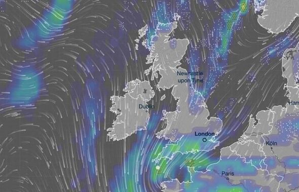
Weather maps published by Metdesk display a white blanket covering vast stretches of the nation, reaching as far south as Buckinghamshire, Oxfordshire and Herefordshire. Snow will begin descending across the North East of England throughout Friday morning, most heavily across Northumberland, whilst other areas along the North Sea coastline will see showers by mid-morning.
However, snow will then become more widespread as, by midday, sections of Yorkshire, the East of England and north Wales will encounter the harsh weather, forecasters say.
Friday afternoon snow will blanket most of the Midlands, before the band of low pressure sweeps across the Home Counties, including Buckinghamshire and Berkshire.
Read more: WHO names lowest temperature to set heating so you don't catch a cold
Read more: Snow maps show 90% of UK buried as new blizzard hits 40 cities - full list
In its outlook for the week's end, the Met Office states: "Unsettled at first with further outbreaks of rain. Turning colder from Friday with a chance of snow showers, particularly in the north. Dry, cold and sunny for many on Saturday."
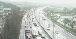
Areas across the South East of England will see substantial rainfall throughout Friday, with snow improbable in locations such as the capital, Essex and Kent. Nevertheless, the light covering is set to create travel chaos across the East of England, East Midlands and sections of the Home Counties.
Whilst Saturday is predicted to remain dry for most, snow is expected to make a comeback on Sunday - and more heavily at that. The most significant accumulations on Sunday are forecast across the Yorkshire Dales and throughout the Scottish Borders.

The bleak outlook is feared to worsen the flooding threat, with communities already struggling following intense rainfall. Numerous flood warnings remain active, including multiple alerts for the River Severn and River Trent in the Midlands.
There are also worries for sections of the River Thames in Berkshire, the Environment Agency confirms.

The intense downpours resulted from a "blocked" weather pattern - a meteorological phenomenon that persists for days or weeks. It can trigger extended rain, droughts or heatwaves.
Chaos and potential flooding could affect eastern Scotland on Tuesday, with 15-30mm of rainfall expected to fall widely and 40-60mm feasible in areas over elevated terrain, the Met Office warned.
Andrew Hitchings, flood duty manager at the Environment Agency, said: "With another band of rain on its way, we need the public to remain vigilant to the risk of flooding."