
Hundreds of thousands of people have been evacuated in Spain, Portugal and Morocco after Storm Leonardo caused widespread flooding.
Emergency services and the military have been helping rescue people from their homes with residents who remain warned to leave immediately.
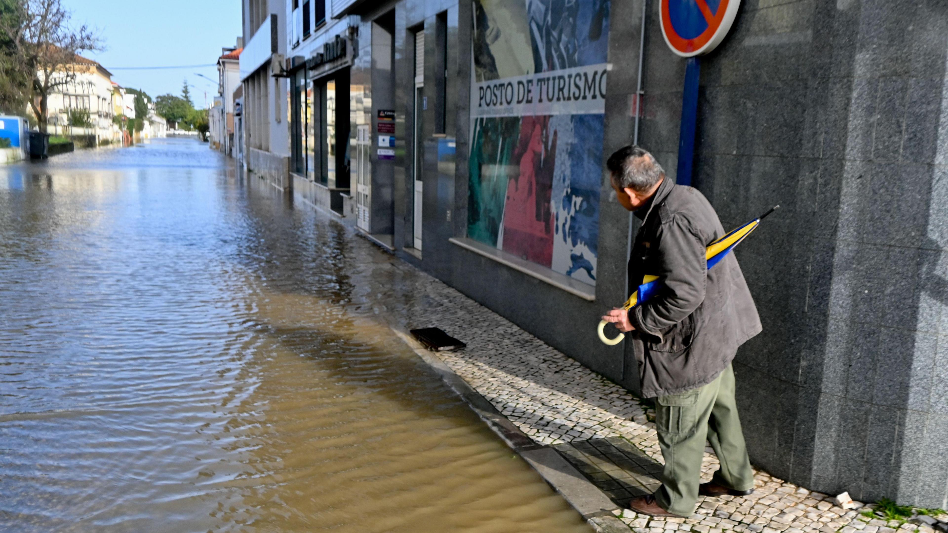
The Portuguese government have extended a state of emergency due to what it describes as the "devastating crisis" caused by a wave of storms.
Saturday will see the arrival of Storm Marta which will bring more rain to the region.
Other parts of Europe have been gripped by very cold weather.
All this is due to a weather pattern that hasn't changed for weeks.

Iberia has been particularly badly affected by spells of wet and windy weather since the turn of the year.
So far this year there have been six major low-pressure systems to hit the Iberian peninsula in 2026. The most recent was Storm Leonardo.
This brought exceptionally wet weather to the Algarve in Portugal and Andalucia in Spain. In this region of Spain, 3,500 people have been evacuated as river levels reached record highs. More than 100 roads have been closed in affected areas due to flooding, landslides or fallen trees and some high speed rail services were suspended.
Grazalema, in a mountainous area of Andalucia, has recorded 672mm (26.4 inches) of rain in a day-and-a-half. This is almost the same amount that London gets in a year.

The next storm to hit Iberia will arrive this weekend. Storm Marta has been named by the Portuguese weather service and will bring strong winds, heavy rain and mountain snow on Friday night and Saturday.
Algarve and Andalucia could get as much as 50mm (2 inches) of rain. The rain is not going to be as heavy as it has been but won't help the current situation.
Wind gusts of 60mph (100kmh) or more are forecast across Iberia, together with 10m waves along the west coast of Portugal. The storm will push rain eastwards right across he Mediterranean early next, continuing the very unsettled weather here.
Impacts of these storms are not just being seen in Europe though.

Tunisia saw its heaviest rainfall in more than 70 years in January. There has also been severe weather and flooding in Algeria.
Morocco has been particularly badly hit in recent weeks. Last month the port of Tangier saw around four times its January average rainfall and more heavy rain hit the north on Wednesday in association with Storm Leonardo.
The army has been deployed to help with evacuations amid a red alert for more heavy rainfall this week. More than 140,000 people in northern parts of the country have been evacuated already.
Authorities have urged residents of flood prone areas in the country's north-western plains to leave immediately with rising threats of inundation from heavy rain, swollen rivers and the release of more water from full dams.
Storm Marta will bring more rain to northern parts of Morocco and Algeria this weekend.
The exceptional rainfall has ended a seven-year drought that had pushed Morocco to accelerate investments in desalination.

While is has been very wet in southern and western Europe, Scandinavia and areas around the Baltic have been exceptionally cold.
In Lithuania temperatures fell to -34.3C (-29.7F) on Monday morning – this is the lowest temperature recorded in the country since 1996.
You would expect Lapland to be cold at this time of year but parts of northern Sweden have had their second coldest January on record.
The persistent cold weather has extended down to Ukraine too. Temperatures in Kyiv have dropped as low as -20C (-4F) and the temperature has risen above freezing on only six days so far this year.
The extreme weather in Europe and north-west Africa is mainly due to a stubborn area of high pressure which has been parked over Scandinavia since the beginning of this year and is responsible for the cold weather.
This high has been blocking areas of low pressure and milder, wet weather from pushing across from the Atlantic, deflecting the jet stream further south. This is why it has been so wet in the UK and other western parts of Europe as well as through the Mediterranean.

Cold, blocking areas of high pressure are notoriously difficult to shift at this time of year. North-east Europe looks like it will stay very cold for much of February. As winds strengthen in some places there will be an added wind-chill.
Some of this cold air could head to the UK later next week and bring the risk of frost, ice and snow.
Areas of low pressure will continue to bring spells of wet and windy weather into central and southern Europe. This will bring the risk of flooding and damage and disruption from strong winds.
For southern Iberia and north-west Africa there may be a glimmer of hope. Areas of high pressure may build across from the Canary Islands at times. Any rain that does fall in the next two weeks will be less widespread and heavy. After Storm Marta should be no new named storms for a week or two at least.