
As the UK prepares to welcome its warmest temperatures of the year this week, forecasts suggest colder and wintry weather could be snapping at its heels. Near-heatwave highs of 27C are expected across the country from Monday, April 28, but the early burst of summery weather could be shortlived, with wet and snowy conditions hitting some regions as soon as next week. Weather maps created by WXCharts using MetDesk data have suggested that a decent chunk of Britain will experience snowfall of up to 2cm on Tuesday, May 6, in an icy spell that could last for around 72 hours, until the early hours of Friday, May 9.
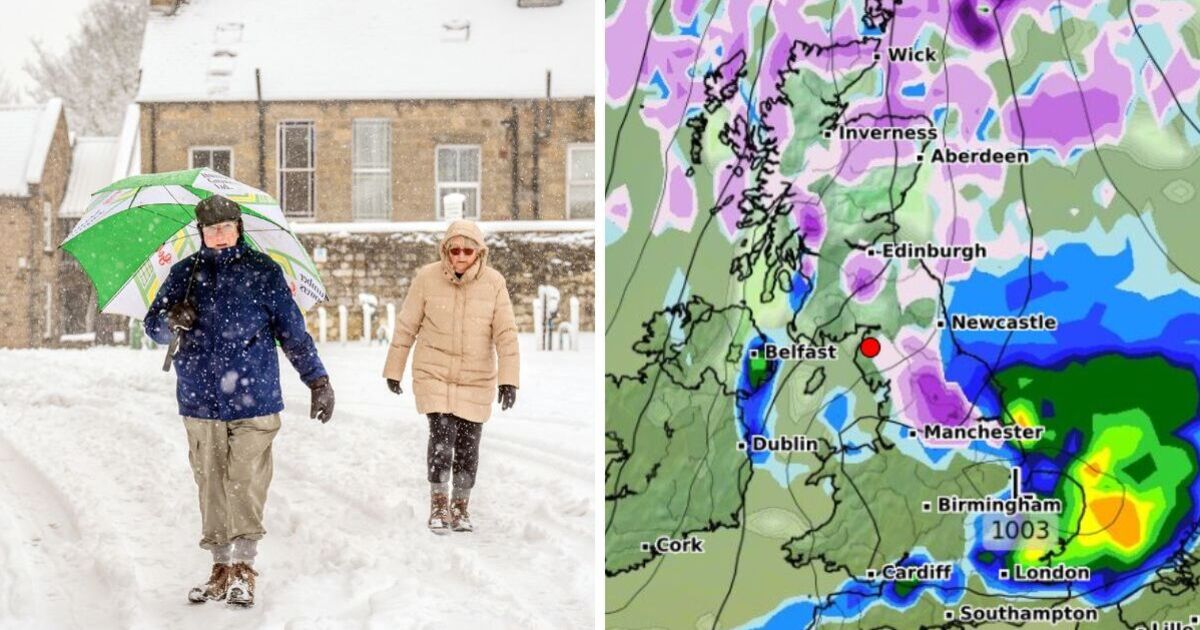
The blitz of disruptive weather could sweep in from the east at around midnight on May 6, initially covering coastal parts of Scotland and a stretch of the Yorkshire coast. By midday, the snow is forecast to settle across Scotland, accumulating particularly heavily around Inverness in the Scottish Highlands, with patchier snowfall stretching from the English border all the way down to Manchester.
Blizzards could continue overnight, accompanied by a drop to subzero temperatures across the UK, including lows of -2C in the Midlands and southern regions around Oxford and Bristol.
A huge stretch of the country might also see heavy rainfall of around 0.8mm per hour by the afternoon of Wednesday, May 7, with eastern coastal areas hit especially hard and the whole of Northern Ireland also drenched in heavy showers.
The Met Office has warned of increasingly "changeable" weather patterns following this week's seasonal highs, suggesting that parts of the UK could experience rainy spells, turning "heavy and thundery" at times.
The forecaster said the warm spell expected this week was unlikely to meet the heatwave threshold of three days over a specified temperature, which is 25C for most of the country and 28C in London.
But a spokesperson acknowledged that the mercury would be "markedly higher" than the 12C to 16C average for April - and said temperatures would return to more typical levels for the time of year from Friday, May 2.
Today:
Some showers in northern and western Scotland but sunny spells elsewhere. Light winds but generally fine and warm weather across England.
Tonight:
Dry conditions with cooler temperatures in the countryside and some rainfall in the Northern Isles.
Tuesday:
Warm and settled conditions across the country, with light winds in some areas.
Outlook for Wednesday to Friday:
Temperatures expected to rise up to 10C above the seasonal average, with dry and sunny conditions in most regions. Low risk of some heavy or thundery showers beginning to develop at the end of the week.