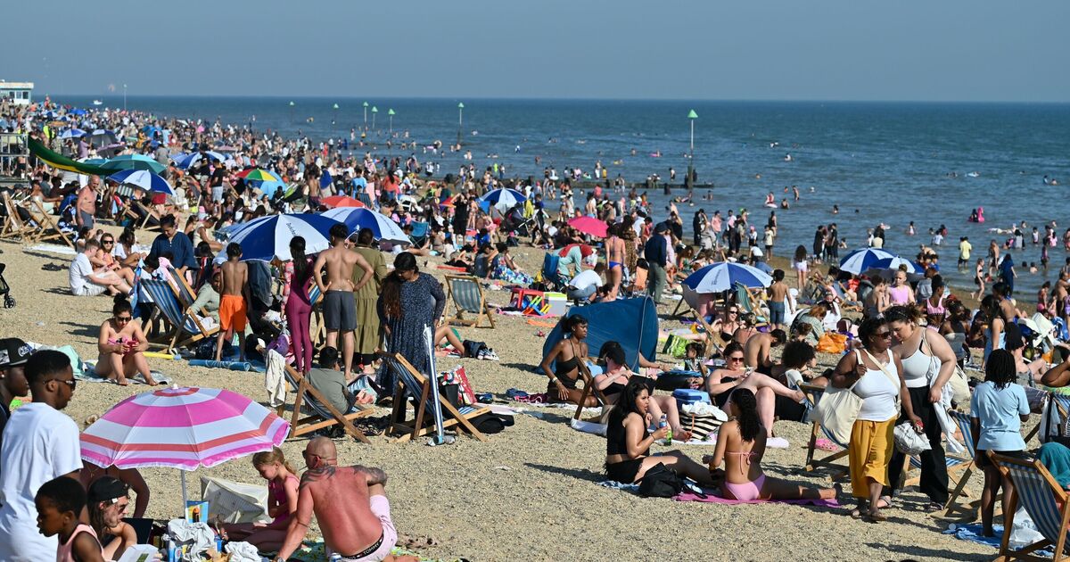

New hot weather maps have shown the UK is set to be hit by a blast of warm air in a matter of days. Hot weather is once again on the way, with the latest weather maps from Netweather showing temperatures could hit 23C in the North West of England at 3pm on Monday, with highs of 22C in London and even northern Scotland, as warm southerly air travels up to the UK.
The rest of the country can expect high that are just a couple of degrees lower, with the Midlands and South Coats likely to see ther mercury hit 20C. Originating from the Iberian Peninsula, the warm draw will bring toasty temperatures, while some parts of the country can expect showers which have come from the Bay of Biscay, along the western coast of France. Jim Dale, senior meteorologist at British Weather Services, said Brits could expect humidity to ramp up in the coming days. He said: "We’re going back into a slightly southerly draw of air so temperatures will be moving up by day and by night it tends to get less cold.
We’re getting that southerly draw but there’s also a lot of cloud coming in, particularly through Sunday and Monday, it’s introducing cloud into the west and southwest, that’s where the showery rain is going to be, moving up across Wales and Ireland in sporadic bursts, so there’ll be some thunderstorms.
"All that means humidity levels will start to rise; you’ll start to feel it.”
Mr Dale continued: “It’s what you might expect, the fact is that when you go into these sorts of regimes, the way it breaks down is a southerly air stream bringing that humid air, thunderstorms and showers and you end up with the increasing temperatures.
“Not everywhere is going to see those showers but it is still the same air mass, so a mass out of the south at this time of year will always be warm and humid, hence the reason for temperatures clinging on in nighttime.
"It will be pretty pleasant if you avoid the showers on Sunday and Monday."
A spokesperson for the Met Office said: "We will have a rise in temperatures this weekend as we draw up warmer and more humid air from the near continent due to an area of low pressure being brought up from the Bay of Biscay leading to south-southeasterly winds.
They said the UK could see highs up to 27C on Sunday or Monday but warned also of the risk of thunderstorms.
Met Office Deputy Chief Meteorologist, Dan Harris, said: "From Saturday night, into Sunday morning, there is an increasing chance of rain, showers and isolated thunderstorms moving northwards across the southwest of the UK.
"As we continue through Sunday and into Monday, this will extend to other western parts of Great Britain and into Northern Ireland too. On Monday itself, we could see some particularly vigorous thunderstorms developing, most likely in Wales and parts of southern England.
"Should these thunderstorms develop, especially on Monday, there is potential for 25-35mm of rain to fall in an hour or so which may lead to some localised surface water flooding. Hail, lightning, and isolated strong wind gusts would be additional hazards. F
"Forecasting exactly where thunderstorms will form at this range is fraught with uncertainty, so please stay up to date with the Met Office forecast through the weekend, and any severe weather warnings which may be issued."